FR
EN
ES
HOME
|
SEARCH A GREENWAY
|
CONTACTS
Vía Verde de la Sierra de Alcaraz
Map:
The Greenway begins and finishes:
The Greenway begins:
Country:
Spain
Region:
Castile-La Mancha
Locality:
Albacete
The Greenway ends:
Country:
Spain
Region:
Castile-La Mancha
Locality:
Alcaraz
Description:
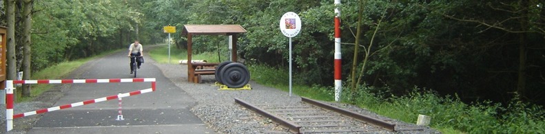
Length :
74 km
Surfaces :
Hard and smooth
Gravelled road
Users :
Pedestrian
Reduced mobility person
Bikes
GreenWay Management Authority:
Organization name:
Diputación Provincial de Albacete
Address:
Paseo de la Libertad, 5
Postcode:
02071
City:
Albacete
Phone:
+34-967595300
Fax:
+34-967520316
Web Address:
www.dipualba.es, www.viaverdeab.es
Contact person:
Juan Gualda, j.gualda@dipualba.es
Complementary Information:
"Sometimes a railway is destined to fail. This is the case of the railway designed to link Talavera de la Reina with the rural district of Las Vegas Altas del Guadiana in Extremadura. The difficulty of the route, in which the mountainous nature of the terrain required a huge engineering effort, caused the project to be shelved before its completion. Today the La Jara Greenway runs between the Montes de Toledo hills and the Villuercas massif in the region of Extremadura"
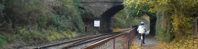
Practical services:
Rest area
Information points
Is a part of:
A non motorised path
A national network
Intermodality:
Train
Details:
Crossed zones:
Albacete, La Herrera, Balazote, Casas de Lázaro, Robledo, Vianos, Salobre, Villapalacios, Bienservid
Points of interest:
Conjunto monumental y museístico de Albacete, Alcaraz y Santuario de Cortes. Llano agrícola de Albacete, cuencas de los ríos Jardín y Cubillo, monte mediterráneo, sabinar en las inmediaciones de Robledo, Reserva Natural Laguna Ojos de Villaverde, Monumento Natural Laguna del Arquillo y Sierra de Alcaraz.
Add a comment
Name*:
Email*:
Write here your comment...
Anti-spam code*:
Back
Association Européenne des Voies Vertes | C/ Santa Isabel, 44 - E 28012 Madrid | Tél.: + 34 91 151 10 98