FR
EN
ES
HOME
|
SEARCH A GREENWAY
|
CONTACTS
Via Verde de Lucainena
Map:
The Greenway begins and finishes:
The Greenway begins:
Country:
Spain
Region:
Andalusia
Locality:
Lucainena de Las Torres
The Greenway ends:
Country:
Spain
Region:
Andalusia
Locality:
Rambla Honda
Description:
Length :
5,5 km
Surfaces :
Hard and smooth
Gravelled road
Users :
Pedestrian
Reduced mobility person
Bikes
Mountain bike
GreenWay Management Authority:
Organization name:
Ayuntamiento de Lucainen
Address:
Plaza Ayuntamiento, 4
Postcode:
4210
City:
Lucainena de las Torres
Phone:
+34-950364068
Email:
culturaydeportes@lucainenadelastorres.es
Web Address:
www.viaverdelucainenadelastorres.org
Contact person:
José Miguel Torrecillas
Complementary Information:
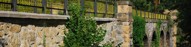
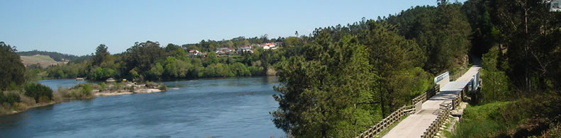
Lucainena de las Torres Greenway The old mining train between Lucainena de las Torres and Agua Amarga has provided us with one of the most authentic routes through inland Almería.Along the foot of the Sierra de Alhamilla mountain range and following the Rambla de Lucainena, a mostly dry river course, we pass over sun-drenched terrain among farmsteads, silence, desert, solitude, mountains and ravines, grateful for any colour or vegetation we might come across
Is a part of:
A non motorised path
A national network
Intermodality:
Bus
Details:
Crossed zones:
Lucainena de las Torres
Points of interest:
Iglesia Parroquial del siglo XVIII, baños termales, hornos mineros de calcinación, calles típicas de Lucainena, premio de embellecimiento en el año 1998. Paraje Natural Sierra Alhamilla y Rambla de Lucainena. A 12 Km Karst en yesos de Sorbas.
Add a comment
Name*:
Email*:
Write here your comment...
Anti-spam code*:
Back
Association Européenne des Voies Vertes | C/ Santa Isabel, 44 - E 28012 Madrid | Tél.: + 34 91 151 10 98