FR
EN
ES
HOME
|
SEARCH A GREENWAY
|
CONTACTS
Tuernitzer Radweg
Map:
The Greenway begins and finishes:
The Greenway begins:
Country:
Austria
Region:
Lower Austria
Locality:
Freiland
The Greenway ends:
Country:
Austria
Region:
Lower Austria
Locality:
Tuernitz
Description:
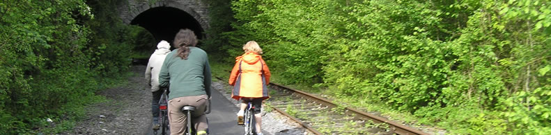
Length :
9 km
Surfaces :
Hard and smooth
Gravelled road
Users :
Pedestrian
Reduced mobility person
Bikes
Mountain bike
Rollers
Cross Country skier
Remarks:
Tuernitzer Radweg has been awarded at the 6th European Greenways Award 2013 with the 1st Prize o the “Excellence“ Category
GreenWay Management Authority:
Organization name:
Marktgemeinde Tuernitz (Municipal Authority Tuernitz)
Address:
Markt Street 28
Postcode:
3184
City:
Tuernitz
Phone:
+43-276982040
Fax:
+43-276982044
Email:
bianca.punz[at]tuernitz.gv.at
Web Address:
http://www.tuernitz-noe.at
Contact person:
Christian Leeb
Tourist Information Authority:
Organization name:
Complementary Information:
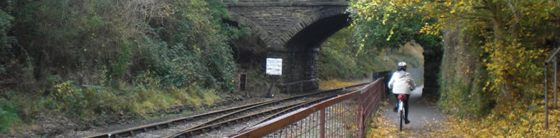
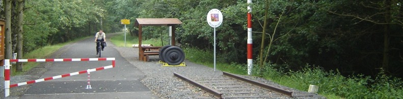
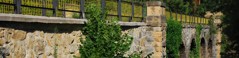
Tuernitz greenway is located in the south of Lower Austria – northeastern of Austria-, at about 100km from Vienna. It connects 3 different villages of the borough of Tuernitz and it is an Idyllic walk along the disused railway line between Freiland and Tuernitz that offers impressive views of the Tuernitz Alps. The hard surface, made of recycled material, makes it suitable for cyclists, walkers and also for cross-country skiers.
Practical services:
Rest area
Pubs
Restaurants
Toilet and Sanitary facilities
Bicycle rental
Bicycle parking area
Information points
Is a part of:
A non motorised path
Intermodality:
Bus
Car park relay
Details:
Crossed zones:
It connects 3 villages of the borough Tuernitz
Width:
3 m
Average slope:
2%
Add a comment
Name*:
Email*:
Write here your comment...
Anti-spam code*:
Back
Association Européenne des Voies Vertes | C/ Santa Isabel, 44 - E 28012 Madrid | Tél.: + 34 91 151 10 98